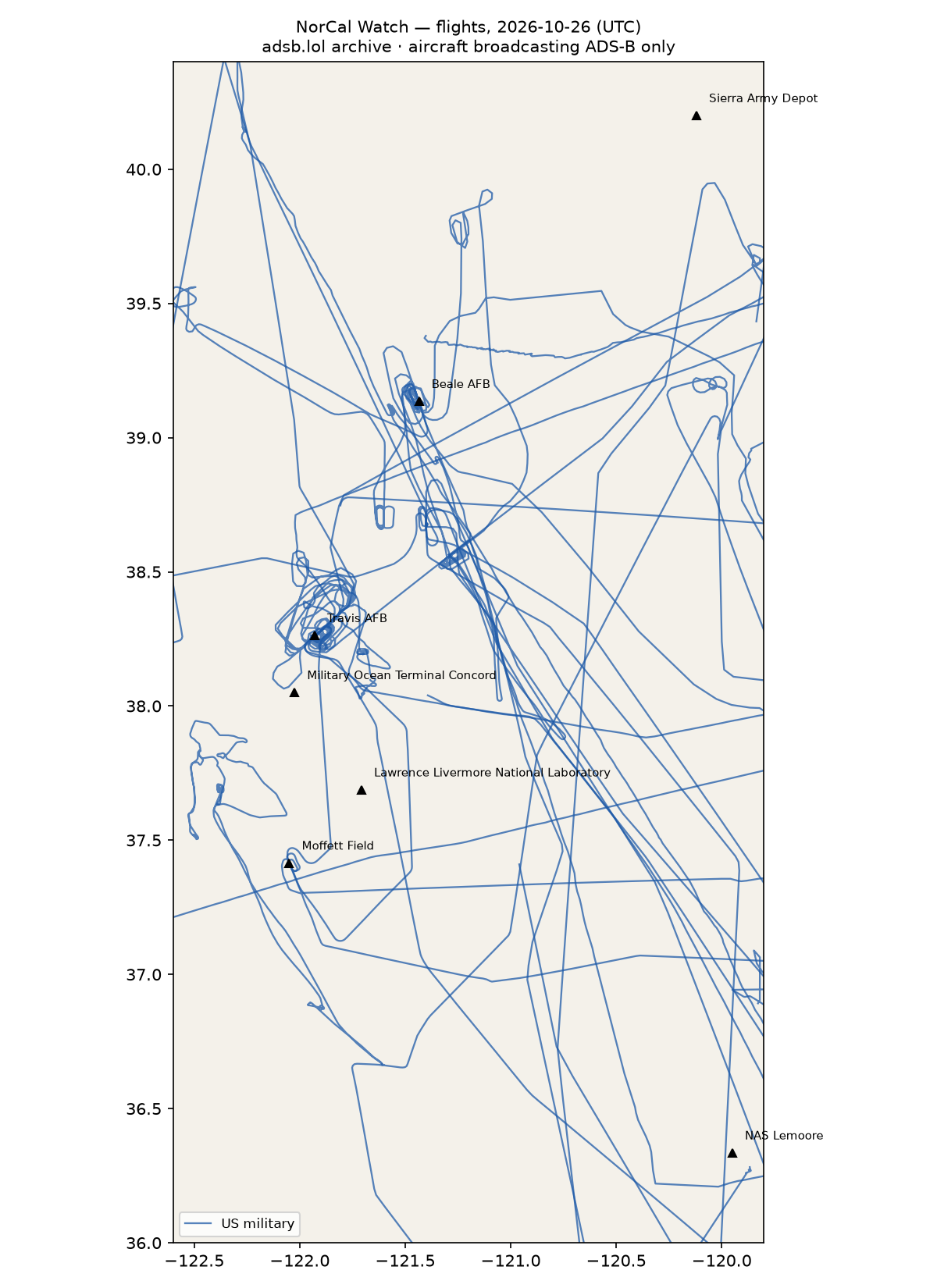
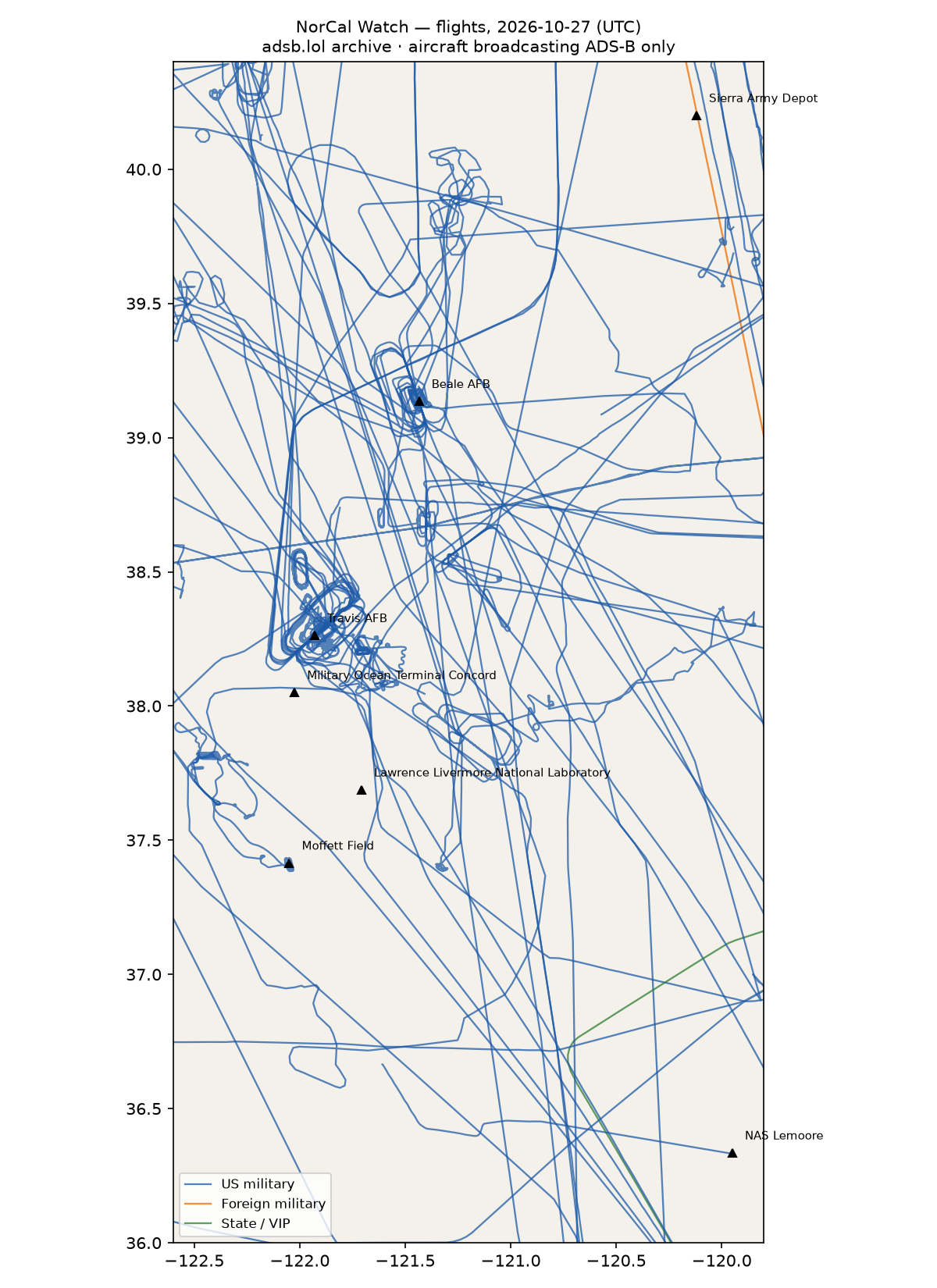
26 other low · 53 US military · 1 foreign military · 1 state/VIP · 418 heat (0 on sites)


Full report
Northern and central California — airlift, reconnaissance, the weapons lab and the depots. Daily open-source look; flights for 2026-10-27 (UTC), heat for 2026-10-27–2026-10-28, newest satellite passes. LLM-generated and automated.
Notable
- 1 foreign military aircraft in the area (other).
Flights
81 aircraft kept: 53 US military, 1 foreign military, 1 state/VIP, 26 other (on the ground at a site, or near a range).
US military
C17 ×8, ? ×7, H60 ×5, AS65 ×3, T38 ×3, C5M ×3, C27J ×3, C30J ×3, H47 ×3, BE20 ×2, C130 ×2, P28A ×2, C172 ×2, C560 ×1, B350 ×1, B762 ×1, K35R ×1, P8 ×1, E2 ×1, EC45 ×1.
- 6525 AS65 C6525 at Moffett Field 16:52 UTC
- 67-14828 T38 ROPER12 ROPER22 ROPER81 at Beale AFB 15:40 UTC
- 06-6160 C17 BLINR27 GRZLY37 at Travis AFB 04:23 UTC
- 68-0213 C5M HEFTY35 at Travis AFB 18:01 UTC
- 65-10342 T38 RECCE02 ROPER31 at Beale AFB 15:15 UTC
- 95-00092 BE20 LOST77 PAT653 at Beale AFB 16:22 UTC
- 98-0056 C17 RCH5002 at Travis AFB 20:54 UTC
- 07-7172 C17 RCH814 RCH987 at Travis AFB 00:42 UTC
- 21-46095 B762 ORCA20 at Travis AFB 16:22 UTC
- ae330a GUCCI21 at Travis AFB 20:10 UTC
- 64-13285 T38 ROPER13 at Beale AFB 19:15 UTC
- 165755 H60 LASSO01 at NAS Lemoore 00:05 UTC
- 59-1508 K35R at Travis AFB 19:44 UTC
- 86-0014 C5M RCH4041 at Travis AFB 00:45 UTC
Foreign military
- other: 98-00010 C560 PAT800 14:05–15:31 UTC
State and VIP
- UR-82027 A124 ANTONOV An-124 Ruslan ADB710F ADB7110 16:22–23:18 UTC
Landings and low passes by site
| Site | Military / government aircraft on the ground or ≤1,500 ft within 4 km; civil count |
|---|---|
| Travis AFB | 07-7172 C17 (RCH814 RCH987) 00:42, 86-0014 C5M (RCH4041) 00:45, 06-6160 C17 (BLINR27 GRZLY37) 04:23, 21-46095 B762 (ORCA20) 16:22, 68-0213 C5M (HEFTY35) 18:01, 59-1508 K35R 19:44, ae330a (GUCCI21) 20:10, 98-0056 C17 (RCH5002) 20:54; 2 civil |
| Beale AFB | 65-10342 T38 (RECCE02 ROPER31) 15:15, 67-14828 T38 (ROPER12 ROPER22 ROPER81) 15:40, 95-00092 BE20 (LOST77 PAT653) 16:22, 64-13285 T38 (ROPER13) 19:15 |
| Lawrence Livermore National Laboratory | — |
| Moffett Field (NASA Ames) | 6525 AS65 (C6525) 16:52; 20 civil |
| Military Ocean Terminal Concord | — |
| NAS Lemoore | 165755 H60 (LASSO01) 00:05 |
| Sierra Army Depot | — |
Heat
418 detections in the watch box (FIRMS area API (agent Gazda)); 0 inside a site box. The Central Valley has seasonal agricultural burning; only heat on a site box is flagged.
| Date | UTC | Lat, lon | FRP | Satellite | Site / nearest |
|---|---|---|---|---|---|
| 2026-10-27 | 0419 | 40.072, -122.191 | 16.06 | Terra | Beale AFB (122.7 km) |
| 2026-10-27 | 0917 | 40.068, -122.192 | 1.7 | N | Beale AFB (122.3 km) |
| 2026-10-27 | 0917 | 40.069, -122.187 | 1.88 | N | Beale AFB (122.3 km) |
| 2026-10-27 | 0917 | 40.070, -122.193 | 1.88 | N | Beale AFB (122.6 km) |
| 2026-10-27 | 0917 | 40.074, -122.192 | 1.7 | N | Beale AFB (122.9 km) |
| 2026-10-27 | 0939 | 37.454, -121.934 | 0.92 | N20 | Moffett Field (NASA Ames) (11.2 km) |
| 2026-10-27 | 0939 | 37.884, -121.186 | 0.76 | N20 | Lawrence Livermore National Laboratory (50.8 km) |
| 2026-10-27 | 0939 | 38.018, -122.117 | 0.67 | N20 | Military Ocean Terminal Concord (8.8 km) |
| 2026-10-27 | 0939 | 40.069, -122.192 | 2.29 | N20 | Beale AFB (122.4 km) |
| 2026-10-27 | 0939 | 40.073, -122.191 | 2.29 | N20 | Beale AFB (122.8 km) |
| 2026-10-27 | 1021 | 37.456, -121.931 | 0.83 | N21 | Moffett Field (NASA Ames) (11.4 km) |
| 2026-10-27 | 1021 | 37.950, -122.397 | 1.08 | N21 | Military Ocean Terminal Concord (34.4 km) |
| 2026-10-27 | 1021 | 38.016, -122.115 | 0.98 | N21 | Military Ocean Terminal Concord (8.8 km) |
| 2026-10-27 | 1021 | 40.069, -122.185 | 2.33 | N21 | Beale AFB (122.1 km) |
| 2026-10-27 | 1021 | 40.070, -122.190 | 2.33 | N21 | Beale AFB (122.5 km) |
| 2026-10-27 | 1021 | 40.074, -122.189 | 2.09 | N21 | Beale AFB (122.7 km) |
| 2026-10-27 | 1058 | 37.942, -122.392 | 0.44 | N | Military Ocean Terminal Concord (34.3 km) |
| 2026-10-27 | 1058 | 38.014, -122.111 | 0.43 | N | Military Ocean Terminal Concord (8.5 km) |
| 2026-10-27 | 1058 | 38.015, -122.115 | 0.43 | N | Military Ocean Terminal Concord (8.8 km) |
| 2026-10-27 | 1058 | 38.087, -121.061 | 0.5 | N | Lawrence Livermore National Laboratory (72.1 km) |
| 2026-10-27 | 1058 | 40.069, -122.190 | 1.49 | N | Beale AFB (122.4 km) |
| 2026-10-27 | 1058 | 40.074, -122.188 | 2.13 | N | Beale AFB (122.7 km) |
| 2026-10-27 | 1117 | 40.072, -122.190 | 2.35 | N20 | Beale AFB (122.6 km) |
| 2026-10-27 | 1754 | 39.087, -121.663 | 27.33 | Terra | Beale AFB (20.4 km) |
| 2026-10-27 | 1754 | 39.641, -122.102 | 29.91 | Terra | Beale AFB (80.3 km) |
| 2026-10-27 | 1754 | 39.755, -122.047 | 41.52 | Terra | Beale AFB (86.7 km) |
| 2026-10-27 | 1754 | 39.759, -122.052 | 31.14 | Terra | Beale AFB (87.3 km) |
| 2026-10-27 | 2002 | 38.251, -120.816 | 11.86 | N21 | Travis AFB (97.2 km) |
| 2026-10-27 | 2002 | 38.253, -120.810 | 11.86 | N21 | Travis AFB (97.8 km) |
| 2026-10-27 | 2002 | 38.257, -120.819 | 11.26 | N21 | Travis AFB (97.0 km) |
| 2026-10-27 | 2004 | 38.327, -121.528 | 23.5 | N21 | Travis AFB (35.9 km) |
| 2026-10-27 | 2004 | 38.328, -121.530 | 12.79 | N21 | Travis AFB (35.7 km) |
| 2026-10-27 | 2004 | 38.330, -121.524 | 12.79 | N21 | Travis AFB (36.2 km) |
| 2026-10-27 | 2004 | 38.516, -121.962 | 14.34 | N21 | Travis AFB (28.3 km) |
| 2026-10-27 | 2004 | 38.520, -121.960 | 13.75 | N21 | Travis AFB (28.7 km) |
| 2026-10-27 | 2004 | 38.544, -121.901 | 20.61 | N21 | Travis AFB (31.4 km) |
| 2026-10-27 | 2004 | 38.546, -121.895 | 19.11 | N21 | Travis AFB (31.7 km) |
| 2026-10-27 | 2004 | 38.578, -122.401 | 10.99 | N21 | Travis AFB (54.0 km) |
| 2026-10-27 | 2004 | 39.087, -121.672 | 5.51 | N21 | Beale AFB (21.1 km) |
| 2026-10-27 | 2004 | 39.088, -121.666 | 5.87 | N21 | Beale AFB (20.6 km) |
Imagery
| Site | Newest clear Sentinel-2 pass (≤12 days) | |
|---|---|---|
| Travis AFB | 2026-10-20 19:03 UTC, 100% clear | no new pass |
| Beale AFB | none clear | |
| Lawrence Livermore National Laboratory | none clear | |
| NAS Lemoore | 2026-10-27 18:54 UTC, 100% clear | no new pass |
| Sierra Army Depot | 2026-10-27 18:53 UTC, 100% clear | no new pass |